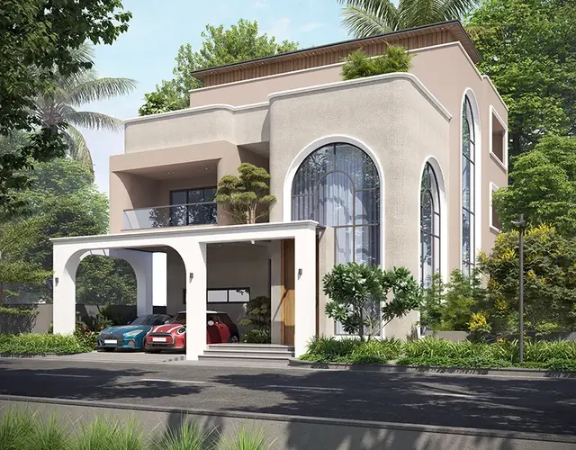
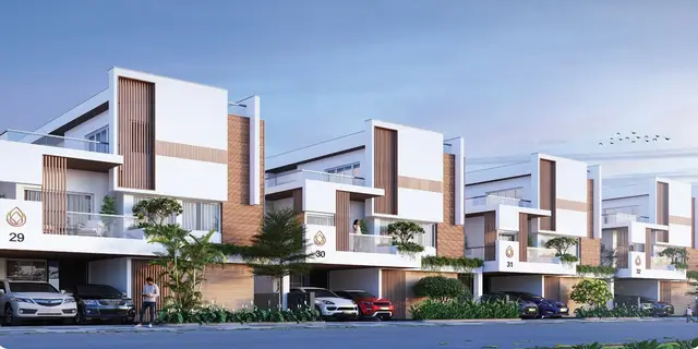
Perams Adithya Prime-2
PHB INFRA DEVELOPERS PVT LTD & GGR INFRASTRUCTURE · Rangareddy · RERA P02400000881
PERAMS ADITHYA PRIME-2 is a plotted development in Mankal, Maheshwaram mandal, Ranga Reddy district. The registration certificate names Ggr Housing India Pvt Ltd & Ggr Infra Developers as the promoter. The layout has a total site area of 50885.81 sq.m and identifies 116 plots, numbered 1 to 116; plot-size configurations are not stated. It is registered under TG-RERA number P02400000881, with proposed completion on 23/05/2024.
01What we found
Read from TG-RERA filings, approvals, land and registration records and court records. A court case is counted only when the court record states this project's survey number with its village, or names the project.
02Check before you pay
9 items to check before you pay, 4 high - from the title chain, court records and approvals, each with what to ask the builder or your advocate. An item may not be a problem with the project: records can be incomplete.
Project at a glance
Project identity
| Field | Record |
|---|---|
| Registered project name | PERAMS ADITHYA PRIME-2 RERA record |
| Project type | Plotted development RERA record |
| Phase / registered portion | Phase not stated; the TG-RERA certificate identifies the project under the registration number below. |
| TG-RERA registration | P02400000881 RERA record |
| Registration validity | 13/06/2019 to 23/05/2024; the certificate says extension is possible only if granted by the Authority under the Act and Rules. No extension is recorded in the supplied evidence. |
| Registered promoter | The shared project record identifies PHB INFRA DEVELOPERS PVT LTD & GGR INFRASTRUCTURE. The registration certificate names “Ggr Housing India Pvt Ltd & Ggr Infra Developers.” RERA record Corporate record |
| RERA status | “On-Going Project” in the project record. The supplied certificate records registration through 23/05/2024; current registration status is not established by the supplied documents. RERA record Approvals record |
Land and geographic identity
| Field | Record |
|---|---|
| Locality / revenue village | Mankal; the layout approval also spells the village “Mankhal.” RERA record RERA filing |
| Mandal | Maheshwaram; the HMDA document uses “Maheswaram Mandal.” RERA record |
| District | Ranga Reddy RERA record |
| PIN | 501359 RERA record |
| Project survey numbers | 526, 527, 539, 540, 541, 542, 543, 544, 545, 546, 547, 548 RERA record Land records |
| Registered site extent / area statement | Total site area: 50885.81 sq.m; master-plan-road-affected area: 8424.5 sq.m; net site area: 42461.31 sq.m. RERA filing |
| Boundaries in the RERA filing | East: SYNO528; West: SYNO615; North: SYNO570; South: SYNO525 RERA filing |
| HMDA layout land-use areas | Plotted area: 27622.22 sq.m; layout roads: 7500.21 sq.m; park/open space: 6270.64 sq.m; social infrastructure: 1068.05 sq.m. |
Development identity
| Field | Record |
|---|---|
| Sanctioning authority | Hyderabad Metropolitan Development Authority (HMDA) Approvals record |
| Principal approval | Draft layout letter No. 000129/LO/Plg/HMDA/2019, approved 23 May 2019; application No. 021581/SMD/LT/U6/HMDA/14032019 Approvals record |
| Approved built-up area | 27622.22 sq.m is recorded as “Approved Built up Area” in the RERA filing. RERA filing |
| Layout scale | The drawing-based layout record identifies 116 plots, numbered 1 to 116; plot sizes are not available in the supplied drawing-derived data. Layout record |
| Buildings / floors | Not applicable as a multi-storey residential building description is not supplied; this is a plotted layout. RERA record |
| Parking | The supplied evidence does not establish a parking-space count or plot-wise parking allocation. Document index Layout record |
Offering and status
| Field | Record |
|---|---|
| Unit type | Plots; the RERA filing classifies the project as plotted development. RERA record RERA filing |
| Unit count / availability | The layout drawing-derived record identifies 116 plot numbers; booked and available plot counts are not supplied. Layout record Document index |
| Construction / development stage | Project record states 80% completeness; this is a recorded progress figure, not an independently verified site inspection. RERA record |
| Original / revised completion | 23/05/2024 / 23/05/2024 in the project record. A Form B declaration states a completion undertaking of “22-5 - 2024.” RERA filing |
| Occupancy / completion certificate | No occupancy or completion certificate is included in the supplied evidence. The project is a plotted layout, and the supplied records do not establish certificate status for the layout. RERA record Document index |
The project story
PERAMS ADITHYA PRIME-2 is a plotted layout in Mankal (also rendered “Mankhal”) village, Maheshwaram mandal, Ranga Reddy district. The RERA filing identifies the project across survey numbers 526, 527 and 539–548; HMDA’s draft layout letter describes the same survey-number set and a net site area of 42461.31 sq.m. RERA record Land records
The supplied layout-derived record reads 116 numbered plots from 1 to 116. The HMDA area statement allocates land to plots, internal roads, park/open space and social infrastructure. It also records plots 89 to 105—17 plots, measuring 4360.71 sq.m—as mortgaged to HMDA pending the specified development and release conditions. Layout record
The project record gives 80% completeness, while the promoter’s Form B declaration undertakes completion by “22-5 - 2024.” These are records of declared progress and undertaking; the supplied pack does not contain an independent site-progress assessment or completion/occupancy certificate. RERA record Document index
Master plan, architecture & building design
This is a plotted layout rather than a residential tower or apartment scheme. The HMDA draft layout letter records a total site area of 50885.81 sq.m, 8424.5 sq.m affected by master-plan roads, and a net site area of 42461.31 sq.m. Its land-use statement allocates 27622.22 sq.m to plots, 7500.21 sq.m to layout roads, 6270.64 sq.m to park/open space and 1068.05 sq.m to social infrastructure.
The drawing-derived layout record counts 116 plots, numbered 1 to 116, but does not provide plot-size measurements. The RERA filing’s 27622.22 sq.m “Approved Built up Area” is retained as filed; the supplied material does not establish a separate gross built-up, carpet-area or saleable-area figure for individual plots. Layout record RERA filing
HMDA lists internal roads, open spaces and social-infrastructure land for handover by registered gift deed before release of final layout plans. The letter also requires roads to remain open for access to neighbouring sites and prohibits construction on plots until final layout release.
Homes, configurations & floor plans
The offering is plots, not apartment configurations. The layout record identifies 116 numbered plots (1 to 116), but plot-size bands and booked/available counts are not provided. No plot-wise saleable-area schedule is available in the supplied evidence. RERA record Layout record Document index
The supplied floor-plan record contains one layout sheet and no measured home plans; it reports no flats. Accordingly, there are no apartment carpet-area or loading figures to present. Floor plans
Parking & vehicle circulation
The supplied material does not establish a count of resident or visitor parking spaces, accessible spaces, or plot-wise parking allocations. No parking levels, mechanical parking, EV charging, or documented exclusive parking rights are identified. Document index Layout record
For vehicle circulation, the HMDA draft layout letter records 7500.21 sq.m of layout road area and refers to proposed 18 m and 30 m master-plan roads. It directs that internal roads remain open for access to neighbouring sites. The supplied evidence does not specify a separate pedestrian network or parking arrangement.
Amenities, recreation & open spaces
The following are recorded in the HMDA draft layout approval, the RERA amenity record, or the promoter/vendor specifications. Where the RERA amenity record reports 100%, that is a recorded status; it is not independent verification of delivery. RERA amenities Promoter website
| Description / size | 6270.64 sq.m; HMDA area statement records 14.77%. |
|---|---|
| Evidence source | Layout record |
| Declared progress / verified status | Provided for in the draft layout; independent completion verification is not supplied. |
| Description / size | 1068.05 sq.m; HMDA area statement records 2.52%. |
|---|---|
| Evidence source | Layout record |
| Declared progress / verified status | Allocated in the draft layout; specific facility or delivery status is not supplied. |
| Description / size | Road area 7500.21 sq.m; HMDA letter requires internal roads to be handed over to the local body by registered gift deed before final layout release. |
|---|---|
| Evidence source | RERA amenities |
| Declared progress / verified status | RERA amenity record marks internal roads and footpaths “YES” at 100%; independent verification is not supplied. |
| Description / size | No separate size or quantity stated beyond the park/open-space allocation above. |
|---|---|
| Evidence source | RERA amenities Promoter website |
| Declared progress / verified status | RERA amenity record marks “YES” at 100%; independent verification is not supplied. |
| Description / size | Included among listed layout facilities; no dimensions or quantity stated. |
|---|---|
| Declared progress / verified status | Specified in the HMDA document; completion status not independently established. |
| Description / size | Listed as a layout facility; no quantity stated. |
|---|---|
| Evidence source | Promoter website |
| Declared progress / verified status | Vendor specifications report tree plantation, landscaping and park development completed; this is a vendor statement, not independent verification. |
| Description / size | No building size or facility description supplied. |
|---|---|
| Evidence source | RERA amenities |
| Declared progress / verified status | Amenity record reports 0%. |
Utilities, building services & safety
The HMDA draft layout letter lists common septic tank/STP, internal water-supply pipelines, an overhead tank, street lights, transformer, rainwater-harvesting pits, storm-water drains, underground drainage lines, a utilities area, solid-waste disposal/dumping and a bio-compost unit. These are specified facilities in the layout record; the supplied evidence does not establish their capacity or independently verify completion.
The RERA amenity record marks water supply, sewerage, storm-water drains, street lighting and water conservation/rainwater harvesting as “YES” at 100%. The vendor specifications additionally state that a water tank was constructed and water supply connected to all plots, and report drainage and electrical works completed; these remain vendor-reported status. RERA amenities Promoter website
The supplied amenity record reports 0% for treatment and disposal of sewage and sullage water, solid-waste management and disposal, energy management, fire protection/fire-safety requirements, and electrical meter room/sub-station/receiving station. The available records do not provide service capacities, fire-safety design details, security systems, accessibility provisions or independent completion evidence. RERA amenities
Location, access & connectivity
The registered location is Mankal village, Maheshwaram mandal, Ranga Reddy district, PIN 501359. The project record gives a cadastral-parcel-centroid coordinate of 17.415275719570207, 78.35458902767974. RERA record Location record
The only supplied measured connectivity distance is Financial District (Nanakramguda), 1.2 km. The HMDA draft layout letter refers to proposed 18 m and 30 m master-plan roads and requires internal roads to remain accessible to neighbouring sites; it does not provide named approach roads or public-transport details. Location record
Developer & development status
The shared project identity record names PHB INFRA DEVELOPERS PVT LTD & GGR INFRASTRUCTURE as the registered promoter and identifies the entity type as “Others,” described in the filing as “Partnership.” The TG-RERA certificate names “Ggr Housing India Pvt Ltd & Ggr Infra Developers.” The supplied documents do not provide corporate identification numbers, a verified registered-office address, official contacts or an official project website. RERA record Corporate record RERA filing
The project record reports 80% completeness and a completion date of 23/05/2024, with the same revised date. No independent progress report or completion/occupancy certificate is supplied. The HMDA document assigns development and handover conditions to the layout and records the authority mortgage over plots 89 to 105. RERA record
Approvals, official records & documents
| Record | Supplied evidence |
|---|---|
| TG-RERA registration | Form C certificate for PERAMS ADITHYA PRIME-2, registration P02400000881, valid 13/06/2019–23/05/2024. |
| HMDA draft layout approval | Draft layout letter No. 000129/LO/Plg/HMDA/2019, dated 23 May 2019; application No. 021581/SMD/LT/U6/HMDA/14032019. |
| Layout drawing | One layout sheet is identified in the drawing-derived record; plot count is software-read from the printed plot numbers and plot sizes are not available in the extracted data. Layout record |
| Form B declaration | Project declaration records a title basis, no-encumbrance statement and completion undertaking of “22-5 - 2024”; it is a promoter declaration. |
| HMDA mortgage and gift-deed references | Mortgage deed No. 13672/2019 (16/05/2019); buffer-area gift deed No. 13673/2019 (16-05-2019); master-plan-road-area gift deed No. 13674/2019 (16-05-2019). |
| Completion / occupancy certificate | Not present in the supplied project documents. Document index |
Project at a glance
Project identity
Registered project name: PERAMS ADITHYA PRIME-2
Project type: Plotted development
Phase / registered portion: Phase not stated; the TG-RERA certificate identifies the project under the registration number below.
TG-RERA registration: P02400000881
Registration validity: 13/06/2019 to 23/05/2024; the certificate says extension is possible only if granted by the Authority under the Act and Rules. No extension is recorded in the supplied evidence.
Registered promoter: The shared project record identifies PHB INFRA DEVELOPERS PVT LTD & GGR INFRASTRUCTURE. The registration certificate names “Ggr Housing India Pvt Ltd & Ggr Infra Developers.”
RERA status: “On-Going Project” in the project record. The supplied certificate records registration through 23/05/2024; current registration status is not established by the supplied documents.
Land and geographic identity
Locality / revenue village: Mankal; the layout approval also spells the village “Mankhal.”
Mandal: Maheshwaram; the HMDA document uses “Maheswaram Mandal.”
District: Ranga Reddy
PIN: 501359
Project survey numbers: 526, 527, 539, 540, 541, 542, 543, 544, 545, 546, 547, 548
Registered site extent / area statement: Total site area: 50885.81 sq.m; master-plan-road-affected area: 8424.5 sq.m; net site area: 42461.31 sq.m.
Boundaries in the RERA filing: East: SYNO528; West: SYNO615; North: SYNO570; South: SYNO525
HMDA layout land-use areas: Plotted area: 27622.22 sq.m; layout roads: 7500.21 sq.m; park/open space: 6270.64 sq.m; social infrastructure: 1068.05 sq.m.
Development identity
Sanctioning authority: Hyderabad Metropolitan Development Authority (HMDA)
Principal approval: Draft layout letter No. 000129/LO/Plg/HMDA/2019, approved 23 May 2019; application No. 021581/SMD/LT/U6/HMDA/14032019
Approved built-up area: 27622.22 sq.m is recorded as “Approved Built up Area” in the RERA filing.
Layout scale: The drawing-based layout record identifies 116 plots, numbered 1 to 116; plot sizes are not available in the supplied drawing-derived data.
Buildings / floors: Not applicable as a multi-storey residential building description is not supplied; this is a plotted layout.
Parking: The supplied evidence does not establish a parking-space count or plot-wise parking allocation.
Offering and status
Unit type: Plots; the RERA filing classifies the project as plotted development.
Unit count / availability: The layout drawing-derived record identifies 116 plot numbers; booked and available plot counts are not supplied.
Construction / development stage: Project record states 80% completeness; this is a recorded progress figure, not an independently verified site inspection.
Original / revised completion: 23/05/2024 / 23/05/2024 in the project record. A Form B declaration states a completion undertaking of “22-5 - 2024.”
Occupancy / completion certificate: No occupancy or completion certificate is included in the supplied evidence. The project is a plotted layout, and the supplied records do not establish certificate status for the layout.
The project story
PERAMS ADITHYA PRIME-2 is a plotted layout in Mankal (also rendered “Mankhal”) village, Maheshwaram mandal, Ranga Reddy district. The RERA filing identifies the project across survey numbers 526, 527 and 539–548; HMDA’s draft layout letter describes the same survey-number set and a net site area of 42461.31 sq.m.
The supplied layout-derived record reads 116 numbered plots from 1 to 116. The HMDA area statement allocates land to plots, internal roads, park/open space and social infrastructure. It also records plots 89 to 105—17 plots, measuring 4360.71 sq.m—as mortgaged to HMDA pending the specified development and release conditions.
The project record gives 80% completeness, while the promoter’s Form B declaration undertakes completion by “22-5 - 2024.” These are records of declared progress and undertaking; the supplied pack does not contain an independent site-progress assessment or completion/occupancy certificate.
Master plan, architecture & building design
This is a plotted layout rather than a residential tower or apartment scheme. The HMDA draft layout letter records a total site area of 50885.81 sq.m, 8424.5 sq.m affected by master-plan roads, and a net site area of 42461.31 sq.m. Its land-use statement allocates 27622.22 sq.m to plots, 7500.21 sq.m to layout roads, 6270.64 sq.m to park/open space and 1068.05 sq.m to social infrastructure.
The drawing-derived layout record counts 116 plots, numbered 1 to 116, but does not provide plot-size measurements. The RERA filing’s 27622.22 sq.m “Approved Built up Area” is retained as filed; the supplied material does not establish a separate gross built-up, carpet-area or saleable-area figure for individual plots.
HMDA lists internal roads, open spaces and social-infrastructure land for handover by registered gift deed before release of final layout plans. The letter also requires roads to remain open for access to neighbouring sites and prohibits construction on plots until final layout release.
Homes, configurations & floor plans
The offering is plots, not apartment configurations. The layout record identifies 116 numbered plots (1 to 116), but plot-size bands and booked/available counts are not provided. No plot-wise saleable-area schedule is available in the supplied evidence.
The supplied floor-plan record contains one layout sheet and no measured home plans; it reports no flats. Accordingly, there are no apartment carpet-area or loading figures to present.
Parking & vehicle circulation
The supplied material does not establish a count of resident or visitor parking spaces, accessible spaces, or plot-wise parking allocations. No parking levels, mechanical parking, EV charging, or documented exclusive parking rights are identified.
For vehicle circulation, the HMDA draft layout letter records 7500.21 sq.m of layout road area and refers to proposed 18 m and 30 m master-plan roads. It directs that internal roads remain open for access to neighbouring sites. The supplied evidence does not specify a separate pedestrian network or parking arrangement.
Amenities, recreation & open spaces
The following are recorded in the HMDA draft layout approval, the RERA amenity record, or the promoter/vendor specifications. Where the RERA amenity record reports 100%, that is a recorded status; it is not independent verification of delivery.
| Description / size | 6270.64 sq.m; HMDA area statement records 14.77%. |
|---|---|
| Declared progress / verified status | Provided for in the draft layout; independent completion verification is not supplied. |
| Description / size | 1068.05 sq.m; HMDA area statement records 2.52%. |
|---|---|
| Declared progress / verified status | Allocated in the draft layout; specific facility or delivery status is not supplied. |
| Description / size | Road area 7500.21 sq.m; HMDA letter requires internal roads to be handed over to the local body by registered gift deed before final layout release. |
|---|---|
| Declared progress / verified status | RERA amenity record marks internal roads and footpaths “YES” at 100%; independent verification is not supplied. |
| Description / size | No separate size or quantity stated beyond the park/open-space allocation above. |
|---|---|
| Declared progress / verified status | RERA amenity record marks “YES” at 100%; independent verification is not supplied. |
| Description / size | Included among listed layout facilities; no dimensions or quantity stated. |
|---|---|
| Declared progress / verified status | Specified in the HMDA document; completion status not independently established. |
| Description / size | Listed as a layout facility; no quantity stated. |
|---|---|
| Declared progress / verified status | Vendor specifications report tree plantation, landscaping and park development completed; this is a vendor statement, not independent verification. |
| Description / size | No building size or facility description supplied. |
|---|---|
| Declared progress / verified status | Amenity record reports 0%. |
Utilities, building services & safety
The HMDA draft layout letter lists common septic tank/STP, internal water-supply pipelines, an overhead tank, street lights, transformer, rainwater-harvesting pits, storm-water drains, underground drainage lines, a utilities area, solid-waste disposal/dumping and a bio-compost unit. These are specified facilities in the layout record; the supplied evidence does not establish their capacity or independently verify completion.
The RERA amenity record marks water supply, sewerage, storm-water drains, street lighting and water conservation/rainwater harvesting as “YES” at 100%. The vendor specifications additionally state that a water tank was constructed and water supply connected to all plots, and report drainage and electrical works completed; these remain vendor-reported status.
The supplied amenity record reports 0% for treatment and disposal of sewage and sullage water, solid-waste management and disposal, energy management, fire protection/fire-safety requirements, and electrical meter room/sub-station/receiving station. The available records do not provide service capacities, fire-safety design details, security systems, accessibility provisions or independent completion evidence.
Location, access & connectivity
The registered location is Mankal village, Maheshwaram mandal, Ranga Reddy district, PIN 501359. The project record gives a cadastral-parcel-centroid coordinate of 17.415275719570207, 78.35458902767974.
The only supplied measured connectivity distance is Financial District (Nanakramguda), 1.2 km. The HMDA draft layout letter refers to proposed 18 m and 30 m master-plan roads and requires internal roads to remain accessible to neighbouring sites; it does not provide named approach roads or public-transport details.
Developer & development status
The shared project identity record names PHB INFRA DEVELOPERS PVT LTD & GGR INFRASTRUCTURE as the registered promoter and identifies the entity type as “Others,” described in the filing as “Partnership.” The TG-RERA certificate names “Ggr Housing India Pvt Ltd & Ggr Infra Developers.” The supplied documents do not provide corporate identification numbers, a verified registered-office address, official contacts or an official project website.
The project record reports 80% completeness and a completion date of 23/05/2024, with the same revised date. No independent progress report or completion/occupancy certificate is supplied. The HMDA document assigns development and handover conditions to the layout and records the authority mortgage over plots 89 to 105.
Approvals, official records & documents
TG-RERA registration: Form C certificate for PERAMS ADITHYA PRIME-2, registration P02400000881, valid 13/06/2019–23/05/2024.
HMDA draft layout approval: Draft layout letter No. 000129/LO/Plg/HMDA/2019, dated 23 May 2019; application No. 021581/SMD/LT/U6/HMDA/14032019.
Layout drawing: One layout sheet is identified in the drawing-derived record; plot count is software-read from the printed plot numbers and plot sizes are not available in the extracted data.
Form B declaration: Project declaration records a title basis, no-encumbrance statement and completion undertaking of “22-5 - 2024”; it is a promoter declaration.
HMDA mortgage and gift-deed references: Mortgage deed No. 13672/2019 (16/05/2019); buffer-area gift deed No. 13673/2019 (16-05-2019); master-plan-road-area gift deed No. 13674/2019 (16-05-2019).
Completion / occupancy certificate: Not present in the supplied project documents.
Frequently asked questions
Is PERAMS ADITHYA PRIME-2 registered with Telangana RERA?
Yes. PERAMS ADITHYA PRIME-2 is registered with the Telangana Real Estate Regulatory Authority as P02400000881; the registration status is On-Going Project.
Who is the developer of PERAMS ADITHYA PRIME-2?
The promoter named in the RERA registration is PHB INFRA DEVELOPERS PVT LTD & GGR INFRASTRUCTURE.
Where is PERAMS ADITHYA PRIME-2 located?
PERAMS ADITHYA PRIME-2 is in MANKAL, Maheshwaram, Rangareddy, Telangana (501359).
When will PERAMS ADITHYA PRIME-2 be completed?
The promoter's proposed date of completion filed with RERA is 23/05/2024. This is the promoter's declaration, not a guarantee.
More projects in Mankal