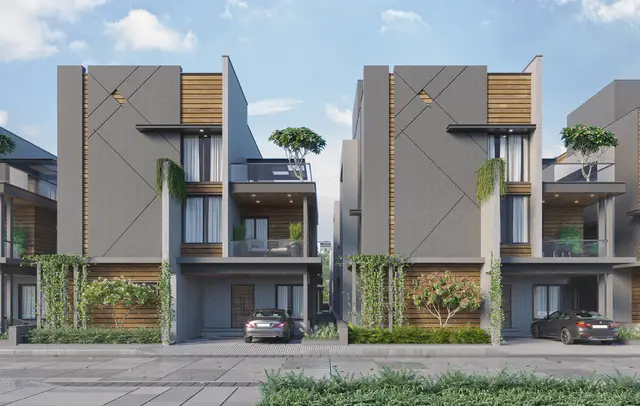
The Ridge
GRUPE BUILDERS & DEVELOPERS LLP AND OTHERS · Rangareddy · RERA P02400010988
THE RIDGE is a new residential open plotted layout in Torrur, Abdullapurmet Mandal, Ranga Reddy District, developed by GRUPE BUILDERS & DEVELOPERS LLP AND OTHERS. The project covers 20790.03 sq.m and contains 69 plots, with plot sizes from 132.59 sq.m to 218.06 sq.m. It is registered under TG-RERA registration number P02400010988, and the promoter’s Form B undertaking states completion by 12th March 2029.
01What we found
Read from TG-RERA filings, approvals, land and registration records and court records. A court case is counted only when the court record states this project's survey number with its village, or names the project.
02Check before you pay
8 items to check before you pay, 5 high - from the title chain, court records and approvals, each with what to ask the builder or your advocate. An item may not be a problem with the project: records can be incomplete.
Project at a glance
Project identity
| Item | Record |
|---|---|
| Registered project name | THE RIDGE RERA record |
| Project type | New project; plotted development / draft residential open plotted layout RERA record RERA filing |
| Phase / registered portion | Phase not separately stated; registration is for the project on Survey No. 382/PART RERA record |
| TG-RERA registration | P02400010988; registration certificate records validity from 12/03/2026 to 12/03/2029 RERA record |
| Registered promoter | GRUPE BUILDERS & DEVELOPERS LLP AND OTHERS RERA record |
| RERA status | Registered; the certificate describes a three-year registration. Registration validity is not the same as a completion deadline or an occupancy/completion certificate. RERA record |
Land and geographic identity
| Item | Record |
|---|---|
| Locality | Torrur RERA record RERA filing |
| Revenue village | THORRUR in the RERA record; the layout documents use Torrur/TORRUR. RERA record |
| Mandal / district / PIN | Abdullapurmet / Ranga Reddy / 501511 RERA record |
| Project survey number and subdivision | 382/PART; the layout documents also render this as Sy. No. 382/PART and 382/p. RERA record |
| Site extent | 20790.03 sq.m in the RERA land details; layout documents state 20790.03 sq.m / Sq. Mt. RERA filing |
| Net / total layout area | 20790.03 sq.m; the layout drawing labels both total and net layout area as 20790.03 sq.m. Layout record |
| Boundaries (RERA-filed) | East: Land in Survey No 382; West: Turkayamjal Village Boundary; North: Land Belongs to V Narender Reddy and Others; South: Land in Survey No 382 by Part. RERA filing |
Development identity
| Item | Record |
|---|---|
| Technical layout authority and principal approval | Hyderabad Metropolitan Development Authority (HMDA); 1849/HMDA/SWDL/2026, dated 17/03/2026 in the HMDA draft layout letter. |
| Layout drawing / permit references | The filed drawing is a draft residential open plotted layout; it also displays LP NO: 02/LO/HMDA/2022. |
| Approved built-up area | 12182.02 sq.m is recorded in the RERA filing as “Approved Built up Area.” The layout land-use schedule identifies the same figure as plotted area; it is not a building-area specification for houses on the plots. RERA filing Layout record |
| Layout area allocation | Plotted area: 12182.02 sq.m; roads: 6370.41 sq.m; open space: 1559.60 sq.m; social infrastructure: 520.08 sq.m; utility: 157.50 sq.m. Layout record |
| Buildings / floors | No count of buildings or sanctioned building floors is disclosed for this plotted layout. The filed layout conditions address construction on plots separately from final layout release. |
| Layout plots | 69 plots, as recorded on the filed drawing. Layout record |
Offering and status
| Item | Record |
|---|---|
| Purchase offering | Plots in a residential open plotted layout; no RERA-filed plot-wise inventory, booked/available count, or plot saleable-area schedule is supplied here. RERA filing |
| Plot sizes | The drawing-derived schedule contains 69 plots with sizes from 132.59 sq.m to 218.06 sq.m; these are software-read from drawing text and should be checked against the drawing. Layout record |
| Construction stage | RERA filing classifies the project as New Project. No independent site-progress verification is supplied. RERA filing RERA record |
| Completion deadline | Promoter’s Form B undertaking states completion by 12th March 2029. This is distinct from the registration certificate’s validity ending 12/03/2029. |
| OC / completion certificate | No occupancy or completion certificate is recorded in the supplied project evidence; the filed layout drawing marks completion certification as false. |
The project story
THE RIDGE is registered as a plotted-development project on Survey No. 382/PART in THORRUR, Abdullapurmet Mandal, Ranga Reddy District. Its filed layout drawing describes a residential open plotted layout of 20790.03 sq.m, containing 69 plots. The drawing allocates land to plots, roads, open space, social infrastructure and utilities. RERA record
The promoter’s Form B undertaking sets 12th March 2029 as the completion date. The evidence supplied does not establish the present construction status through an independent site inspection, nor does it record an occupancy or completion certificate. The layout permission is described in the filed documents as draft layout permission; its conditions call for infrastructure works and local-body handover of designated areas before final layout release.
Master plan, architecture & building design
The filed drawing is a draft residential open plotted layout, not a set of house or apartment plans. Its schedule records 69 plots within a net layout area of 20790.03 sq.m. The software-read plot schedule gives plot sizes from 132.59 sq.m (158.6 sq.yd) to 218.06 sq.m (260.8 sq.yd), with a median of 167.23 sq.m (200.0 sq.yd); drawing-derived values should be verified against the drawing. Layout record
| Layout use | Area | Share shown |
|---|---|---|
| Plotted area | 12182.02 sq.m | 58.60% |
| Roads | 6370.41 sq.m | 30.64% |
| Open space | 1559.60 sq.m | 7.50% |
| Social infrastructure | 520.08 sq.m | 2.50% |
| Utility area | 157.50 sq.m | 0.76% |
Layout record
The drawing lists road widths of 30.0 m, 12.19 m and 9.14 m. It also labels social infrastructure, public utility, sump, ST, TF, GB & BC and cycle track; these drawing labels do not, by themselves, establish that facilities are complete or operational.
The filed layout permission identifies mortgage areas over Plot Nos. 1 to 11, extent 1989.41 sq.m, and Plot Nos. 12 to 15, extent 707.77 sq.m, in favour of the Metropolitan Commissioner, HMDA. It also specifies gift-deed handover to the local body, before final layout release, of the roads, open space, social-infrastructure area and utility area.
Homes, configurations & floor plans
This is a plotted project, so apartment configuration and carpet-area measurements are not applicable. The filed drawing records 69 plots; no RERA-filed booked/available count or complete plot-wise RERA saleable-area schedule is supplied. The drawing-derived plot sizes are software-read rather than RERA unit disclosures. Layout record
| Plot-size band | Plot count |
|---|---|
| 150–200 sq.yd (125–167 sq.m) | 23 |
| 200–250 sq.yd (167–209 sq.m) | 43 |
| 250–300 sq.yd (209–251 sq.m) | 3 |
Layout record
Parking & vehicle circulation
The filed layout schedule records 0.00 sq.m as common parking area. No count or allocation of resident, visitor or accessible parking spaces is supplied. The drawing lists internal roads of 30.0 m, 12.19 m and 9.14 m; plot-specific parking arrangements are not established by the material supplied. Layout record
Amenities, recreation & open spaces
The RERA filing marks several layout-infrastructure categories as available, but records 0% progress for each category. This is a filing status, not independent confirmation of completion. RERA amenities
| Facility / category | Description / size | Evidence source | Declared progress / verified status |
|---|---|---|---|
| Landscape / open space | Open space: 1559.60 sq.m; the filed plan labels a green strip/tot-lot/park. | RERA amenities | Category marked available; 0% recorded. Completion not independently verified. |
| Social infrastructure | 520.08 sq.m allocated. | No facility-specific progress or completion evidence supplied. | |
| Community buildings | Listed in the RERA amenity schedule; no size or specific building details supplied. | RERA amenities | 0% recorded; no completion evidence supplied. |
| Recreation | The filed drawing labels cycle track. | The layout permission requires cycle tracks; completion not independently verified. |
The promoter’s website flyer additionally markets facilities including a clubhouse, gym, party hall, indoor games room, gardens and sports features. These are marketing claims, not treated here as RERA-filed, sanctioned or delivered facilities.
Utilities, building services & safety
The RERA amenity schedule marks water supply, sewerage, storm-water drains, street lighting, sewage treatment/disposal, solid-waste management, rainwater harvesting and an electrical meter room/sub-station/receiving station as available, each with 0% progress recorded. The supplied record does not provide capacities or independent completion verification. RERA amenities
The HMDA draft layout conditions specify potable-water pipeline connectivity, underground storm-water drainage, underground ducting for utilities, solid-waste segregation and disposal arrangements, bio-composting, paved footpaths, and LED street lighting. The permission also lists common septic tank/STP, overhead tank, transformer, rainwater-harvesting pits and park development as layout infrastructure. These are prescribed or listed provisions; the documents supplied do not establish that they have been completed.
Location, access & connectivity
The registered project location is THORRUR, Abdullapurmet Mandal, Ranga Reddy District, PIN 501511, on Survey No. 382/PART. The RERA-filed boundaries identify land in Survey No. 382 to the east and south, Turkayamjal Village Boundary to the west, and land belonging to V Narender Reddy and Others to the north. RERA record RERA filing
The location data provides a sampled nearest Outer Ring Road interchange at 7.7 km (approx.). No additional independently measured approach-road or public-transport distances are supplied. Location record
Developer & development status
The registered promoter is GRUPE BUILDERS & DEVELOPERS LLP AND OTHERS, described in the RERA filing as an LLP and as a joint-development project. The recorded GSTIN is 36AAXFG4121F1ZC. RERA record RERA filing Corporate record
A project-specific development agreement identifies GRUPE BUILDERS AND DEVELOPERS LLP and four landowners—VANGETI GOPAL REDDY, JAKKA SATHI REDDY, VANGETI NARENDER REDDY and VANGETI RANADHEER REDDY—as parties to a joint development and sale arrangement; it states that costs and sale proceeds are shared by an unspecified agreed ratio.
The Form B declaration, made in April 2026 (day not stated), undertakes completion by 12th March 2029. The supplied evidence does not include independently verified site progress. The RERA certificate is for P02400010988 and is valid through 12/03/2029, unless extended by the Authority.
Approvals, official records & documents
| Record | What the supplied document establishes |
|---|---|
| TG-RERA registration certificate, P02400010988 | Form C certificate for THE RIDGE, identifying the promoter, location and Survey No. 382/PART; validity 12/03/2026–12/03/2029. |
| HMDA draft layout approval, 1849/HMDA/SWDL/2026 | Draft open-layout permission for 20790.03 sq.m on Survey No. 382/PART, dated 17/03/2026; includes layout allocations, mortgage areas and conditions. |
| HMDA layout drawing | Draft residential open plotted layout showing 69 plots, land-use allocation and road widths. The drawing records authority-related references including LP NO: 02/LO/HMDA/2022. |
| Earlier-stage HMDA layout letter | “APPROVAL FOR LAYOUT PERMISSION” dated 12/03/2026; states that the approval and plans were forwarded to Turkayamjal Municipality for release of proceedings and plans. |
| Form B promoter declaration | Promoter declaration concerning title, encumbrances, project-account obligations and the completion undertaking of 12th March 2029. |
No occupancy or completion certificate is present in the supplied evidence. The HMDA draft layout documents state that permission is not proof of land title and set out further infrastructure and handover conditions for final layout release.
Project at a glance
Project identity
Registered project name: THE RIDGE
Project type: New project; plotted development / draft residential open plotted layout
Phase / registered portion: Phase not separately stated; registration is for the project on Survey No. 382/PART
TG-RERA registration: P02400010988; registration certificate records validity from 12/03/2026 to 12/03/2029
Registered promoter: GRUPE BUILDERS & DEVELOPERS LLP AND OTHERS
RERA status: Registered; the certificate describes a three-year registration. Registration validity is not the same as a completion deadline or an occupancy/completion certificate.
Land and geographic identity
Locality: Torrur
Revenue village: THORRUR in the RERA record; the layout documents use Torrur/TORRUR.
Mandal / district / PIN: Abdullapurmet / Ranga Reddy / 501511
Project survey number and subdivision: 382/PART; the layout documents also render this as Sy. No. 382/PART and 382/p.
Site extent: 20790.03 sq.m in the RERA land details; layout documents state 20790.03 sq.m / Sq. Mt.
Net / total layout area: 20790.03 sq.m; the layout drawing labels both total and net layout area as 20790.03 sq.m.
Boundaries (RERA-filed): East: Land in Survey No 382; West: Turkayamjal Village Boundary; North: Land Belongs to V Narender Reddy and Others; South: Land in Survey No 382 by Part.
Development identity
Technical layout authority and principal approval: Hyderabad Metropolitan Development Authority (HMDA); 1849/HMDA/SWDL/2026, dated 17/03/2026 in the HMDA draft layout letter.
Layout drawing / permit references: The filed drawing is a draft residential open plotted layout; it also displays LP NO: 02/LO/HMDA/2022.
Approved built-up area: 12182.02 sq.m is recorded in the RERA filing as “Approved Built up Area.” The layout land-use schedule identifies the same figure as plotted area; it is not a building-area specification for houses on the plots.
Layout area allocation: Plotted area: 12182.02 sq.m; roads: 6370.41 sq.m; open space: 1559.60 sq.m; social infrastructure: 520.08 sq.m; utility: 157.50 sq.m.
Buildings / floors: No count of buildings or sanctioned building floors is disclosed for this plotted layout. The filed layout conditions address construction on plots separately from final layout release.
Layout plots: 69 plots, as recorded on the filed drawing.
Offering and status
Purchase offering: Plots in a residential open plotted layout; no RERA-filed plot-wise inventory, booked/available count, or plot saleable-area schedule is supplied here.
Plot sizes: The drawing-derived schedule contains 69 plots with sizes from 132.59 sq.m to 218.06 sq.m; these are software-read from drawing text and should be checked against the drawing.
Construction stage: RERA filing classifies the project as New Project. No independent site-progress verification is supplied.
Completion deadline: Promoter’s Form B undertaking states completion by 12th March 2029. This is distinct from the registration certificate’s validity ending 12/03/2029.
OC / completion certificate: No occupancy or completion certificate is recorded in the supplied project evidence; the filed layout drawing marks completion certification as false.
The project story
THE RIDGE is registered as a plotted-development project on Survey No. 382/PART in THORRUR, Abdullapurmet Mandal, Ranga Reddy District. Its filed layout drawing describes a residential open plotted layout of 20790.03 sq.m, containing 69 plots. The drawing allocates land to plots, roads, open space, social infrastructure and utilities.
The promoter’s Form B undertaking sets 12th March 2029 as the completion date. The evidence supplied does not establish the present construction status through an independent site inspection, nor does it record an occupancy or completion certificate. The layout permission is described in the filed documents as draft layout permission; its conditions call for infrastructure works and local-body handover of designated areas before final layout release.
Master plan, architecture & building design
The filed drawing is a draft residential open plotted layout, not a set of house or apartment plans. Its schedule records 69 plots within a net layout area of 20790.03 sq.m. The software-read plot schedule gives plot sizes from 132.59 sq.m (158.6 sq.yd) to 218.06 sq.m (260.8 sq.yd), with a median of 167.23 sq.m (200.0 sq.yd); drawing-derived values should be verified against the drawing.
| Layout use | Area | Share shown |
|---|---|---|
| Plotted area | 12182.02 sq.m | 58.60% |
| Roads | 6370.41 sq.m | 30.64% |
| Open space | 1559.60 sq.m | 7.50% |
| Social infrastructure | 520.08 sq.m | 2.50% |
| Utility area | 157.50 sq.m | 0.76% |
The drawing lists road widths of 30.0 m, 12.19 m and 9.14 m. It also labels social infrastructure, public utility, sump, ST, TF, GB & BC and cycle track; these drawing labels do not, by themselves, establish that facilities are complete or operational.
The filed layout permission identifies mortgage areas over Plot Nos. 1 to 11, extent 1989.41 sq.m, and Plot Nos. 12 to 15, extent 707.77 sq.m, in favour of the Metropolitan Commissioner, HMDA. It also specifies gift-deed handover to the local body, before final layout release, of the roads, open space, social-infrastructure area and utility area.
Homes, configurations & floor plans
This is a plotted project, so apartment configuration and carpet-area measurements are not applicable. The filed drawing records 69 plots; no RERA-filed booked/available count or complete plot-wise RERA saleable-area schedule is supplied. The drawing-derived plot sizes are software-read rather than RERA unit disclosures.
150–200 sq.yd (125–167 sq.m): 23
200–250 sq.yd (167–209 sq.m): 43
250–300 sq.yd (209–251 sq.m): 3
Parking & vehicle circulation
The filed layout schedule records 0.00 sq.m as common parking area. No count or allocation of resident, visitor or accessible parking spaces is supplied. The drawing lists internal roads of 30.0 m, 12.19 m and 9.14 m; plot-specific parking arrangements are not established by the material supplied.
Amenities, recreation & open spaces
The RERA filing marks several layout-infrastructure categories as available, but records 0% progress for each category. This is a filing status, not independent confirmation of completion.
| Facility / category | Description / size | Evidence source | Declared progress / verified status |
|---|---|---|---|
| Landscape / open space | Open space: 1559.60 sq.m; the filed plan labels a green strip/tot-lot/park. | Category marked available; 0% recorded. Completion not independently verified. | |
| Social infrastructure | 520.08 sq.m allocated. | No facility-specific progress or completion evidence supplied. | |
| Community buildings | Listed in the RERA amenity schedule; no size or specific building details supplied. | 0% recorded; no completion evidence supplied. | |
| Recreation | The filed drawing labels cycle track. | The layout permission requires cycle tracks; completion not independently verified. |
The promoter’s website flyer additionally markets facilities including a clubhouse, gym, party hall, indoor games room, gardens and sports features. These are marketing claims, not treated here as RERA-filed, sanctioned or delivered facilities.
Utilities, building services & safety
The RERA amenity schedule marks water supply, sewerage, storm-water drains, street lighting, sewage treatment/disposal, solid-waste management, rainwater harvesting and an electrical meter room/sub-station/receiving station as available, each with 0% progress recorded. The supplied record does not provide capacities or independent completion verification.
The HMDA draft layout conditions specify potable-water pipeline connectivity, underground storm-water drainage, underground ducting for utilities, solid-waste segregation and disposal arrangements, bio-composting, paved footpaths, and LED street lighting. The permission also lists common septic tank/STP, overhead tank, transformer, rainwater-harvesting pits and park development as layout infrastructure. These are prescribed or listed provisions; the documents supplied do not establish that they have been completed.
Location, access & connectivity
The registered project location is THORRUR, Abdullapurmet Mandal, Ranga Reddy District, PIN 501511, on Survey No. 382/PART. The RERA-filed boundaries identify land in Survey No. 382 to the east and south, Turkayamjal Village Boundary to the west, and land belonging to V Narender Reddy and Others to the north.
The location data provides a sampled nearest Outer Ring Road interchange at 7.7 km (approx.). No additional independently measured approach-road or public-transport distances are supplied.
Developer & development status
The registered promoter is GRUPE BUILDERS & DEVELOPERS LLP AND OTHERS, described in the RERA filing as an LLP and as a joint-development project. The recorded GSTIN is 36AAXFG4121F1ZC.
A project-specific development agreement identifies GRUPE BUILDERS AND DEVELOPERS LLP and four landowners—VANGETI GOPAL REDDY, JAKKA SATHI REDDY, VANGETI NARENDER REDDY and VANGETI RANADHEER REDDY—as parties to a joint development and sale arrangement; it states that costs and sale proceeds are shared by an unspecified agreed ratio.
The Form B declaration, made in April 2026 (day not stated), undertakes completion by 12th March 2029. The supplied evidence does not include independently verified site progress. The RERA certificate is for P02400010988 and is valid through 12/03/2029, unless extended by the Authority.
Approvals, official records & documents
TG-RERA registration certificate, P02400010988: Form C certificate for THE RIDGE, identifying the promoter, location and Survey No. 382/PART; validity 12/03/2026–12/03/2029.
HMDA draft layout approval, 1849/HMDA/SWDL/2026: Draft open-layout permission for 20790.03 sq.m on Survey No. 382/PART, dated 17/03/2026; includes layout allocations, mortgage areas and conditions.
HMDA layout drawing: Draft residential open plotted layout showing 69 plots, land-use allocation and road widths. The drawing records authority-related references including LP NO: 02/LO/HMDA/2022.
Earlier-stage HMDA layout letter: “APPROVAL FOR LAYOUT PERMISSION” dated 12/03/2026; states that the approval and plans were forwarded to Turkayamjal Municipality for release of proceedings and plans.
Form B promoter declaration: Promoter declaration concerning title, encumbrances, project-account obligations and the completion undertaking of 12th March 2029.
No occupancy or completion certificate is present in the supplied evidence. The HMDA draft layout documents state that permission is not proof of land title and set out further infrastructure and handover conditions for final layout release.
Frequently asked questions
Is THE RIDGE registered with Telangana RERA?
Yes. THE RIDGE is registered with the Telangana Real Estate Regulatory Authority as P02400010988; the registration status is New Project.
Who is the developer of THE RIDGE?
The promoter named in the RERA registration is GRUPE BUILDERS & DEVELOPERS LLP AND OTHERS.
Where is THE RIDGE located?
THE RIDGE is in Torrur, THORRUR, Abdullapurmet, Rangareddy, Telangana (501511).
When will THE RIDGE be completed?
The promoter's proposed date of completion filed with RERA is 12/07/2029. This is the promoter's declaration, not a guarantee.
More projects in Thorrur